
GMRT: Known Issues
The Global Multi-Resolution Topography (GMRT) Synthesis is a continually evolving compilation. The content in the 100-m resolution ping layer is updated at least twice per year, and the underlying predicted bathymetry grid is updated less frequently. There are a number of known issue in the compilation that are documented here. Please contact us to report any additional issues.
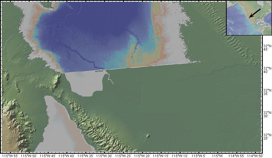
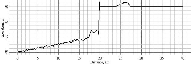
- A step-like discrepancy following the US-Mexican border across the Salton Trough (map view, profile).
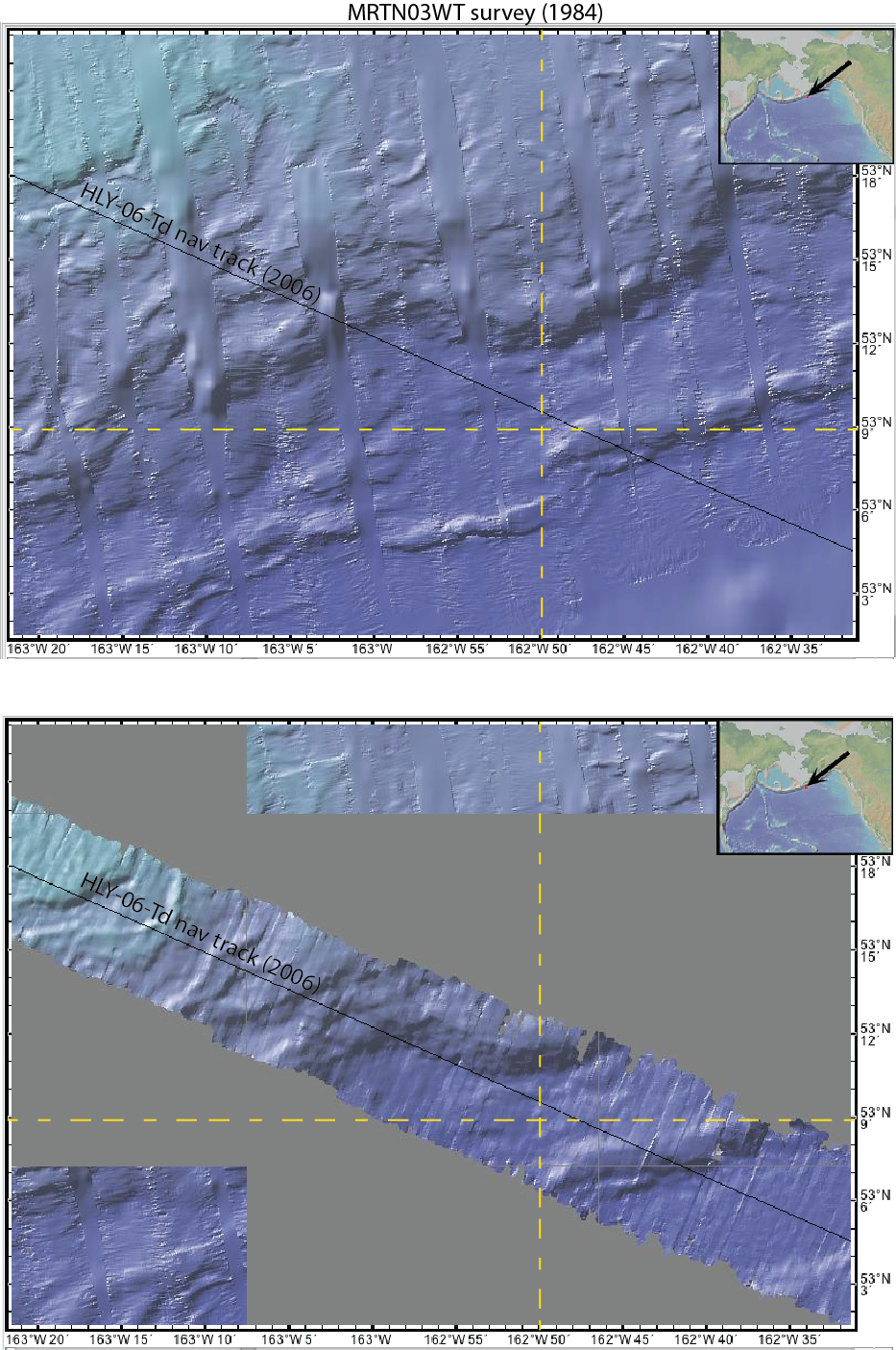
- MRTN03WT navigational offset ~ 52°N, 163°W. Until recently, MRTN03WT provided the only multibeam coverage in this area. Conducted in 1984, this cruise was navigated with Loran, and although the data were processed, modern data collected aboard the USCGC Healy (e.g. HLY-06-Td), reveal that the MRTN03WT survey is offset to the north by ~3km. (view image)
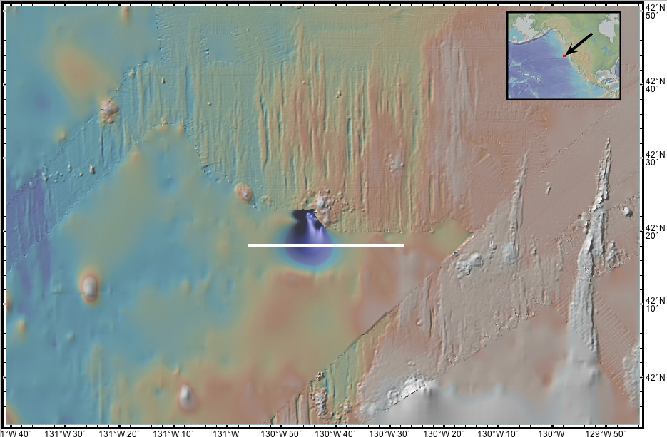
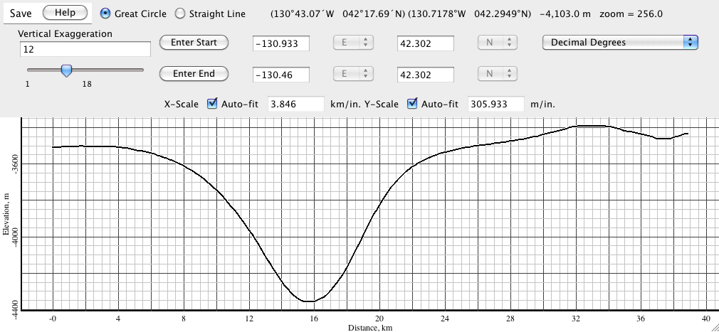
- The Smith and Sandwell predicted bathymetry compilation has a depth anomaly west of the JdF/Gorda plates -- a 4000 m hole is evident at the edge of a swath associated with cruise WEST15MV at location -130.75 W, 42.36 N (map view, profile)
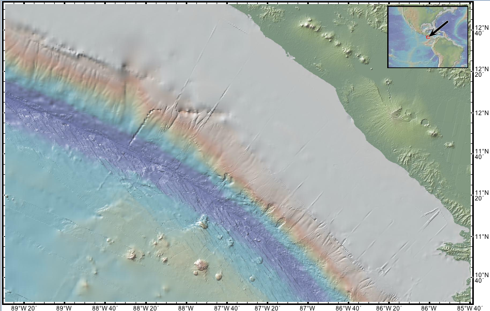
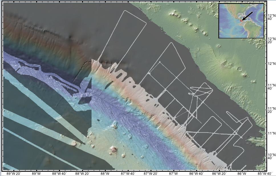
- The Smith and Sandwell predicted bathymetry compilation has a depth anomaly on the continental slope near Costa Rica (View Image). This area falls within the masked area indicating that it is not part of the 100-m swath data component of GMRT.
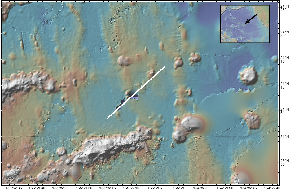
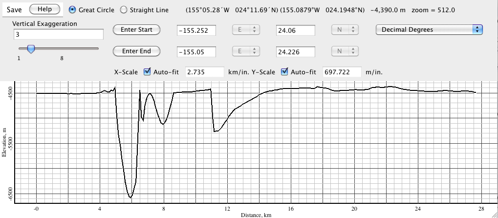
- The Smith and Sandwell predicted bathymetry compilation has a 2000 m depth anomaly near Hawaii at 24°8'N, 155°10'W (map view, profile). This area is largely overprinted by content in the 100-m swath data component of GMRT, but some of it is still evident.
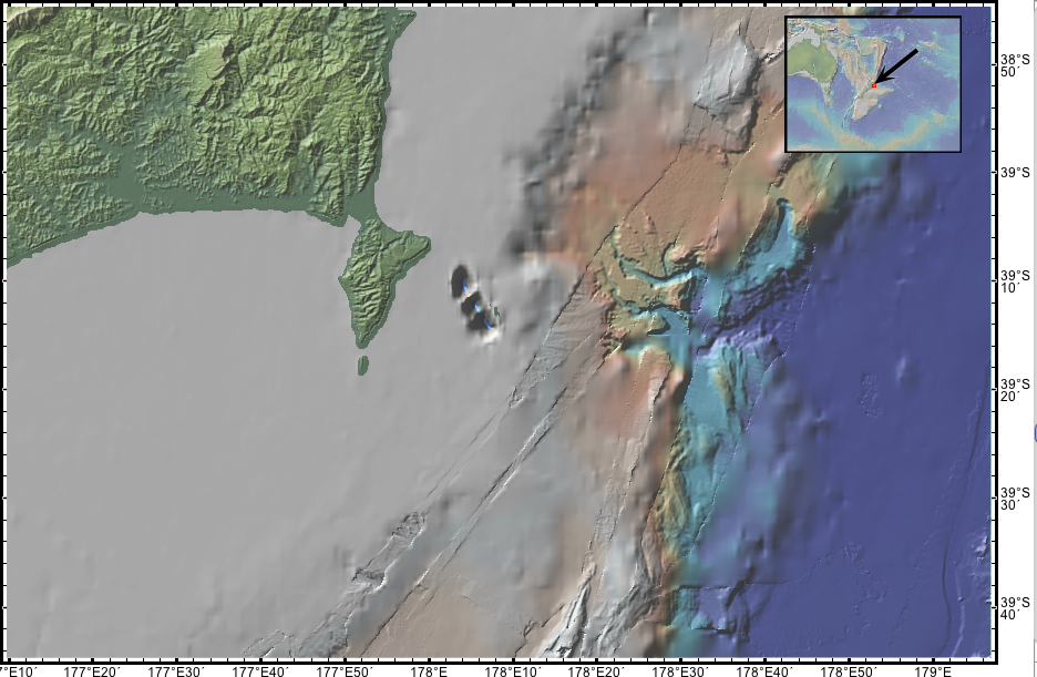
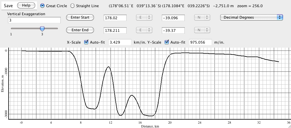
- The Smith and Sandwell predicted bathymetry compilation has a 3000 m depth anomaly on the continentals shelf off the north island of New Zealand at 39°10'S, 178°04'E (map view, profile).
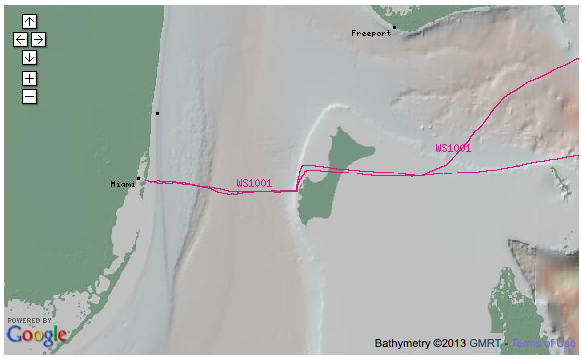
- Land-based data included in the GMRT synthesis from the the ASTER compilation, erroneously shows an area of ocean as an island off Miami, near the Bimini Islands. (map view).
- At some resolutions, a rogue tile with zero elevation overprints an the vicinity of the Line Islands at 2°N, 158°W (map view).
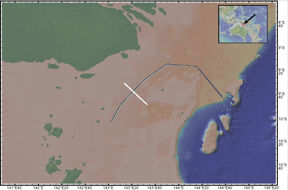
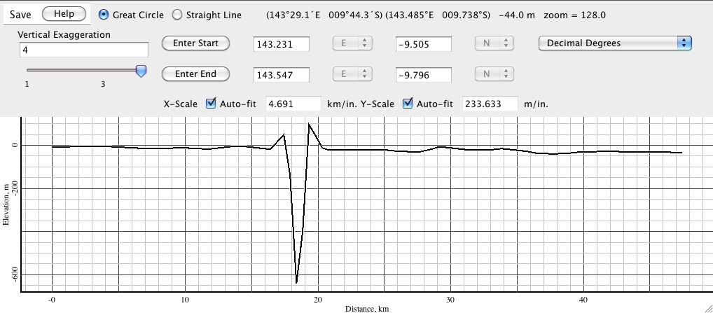
- Bad data associated with VANC12MV result in a 600m deep hole in the continental shelf near Australia/Papua New Guinea (map view, profile).
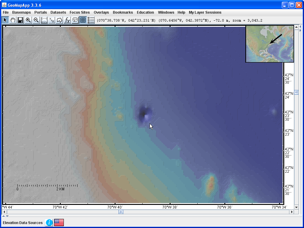
- The Smith-Sandwell predicted bathymetry displays a conical 50m-deep hole in Massachusetts Bay (map view).
